YOUR VOTE IS CHANGING: We need your input to ensure fair board elections!
PUBLIC INPUT FOR DISTRICT ELECTION MAPS
NEW UPDATES -
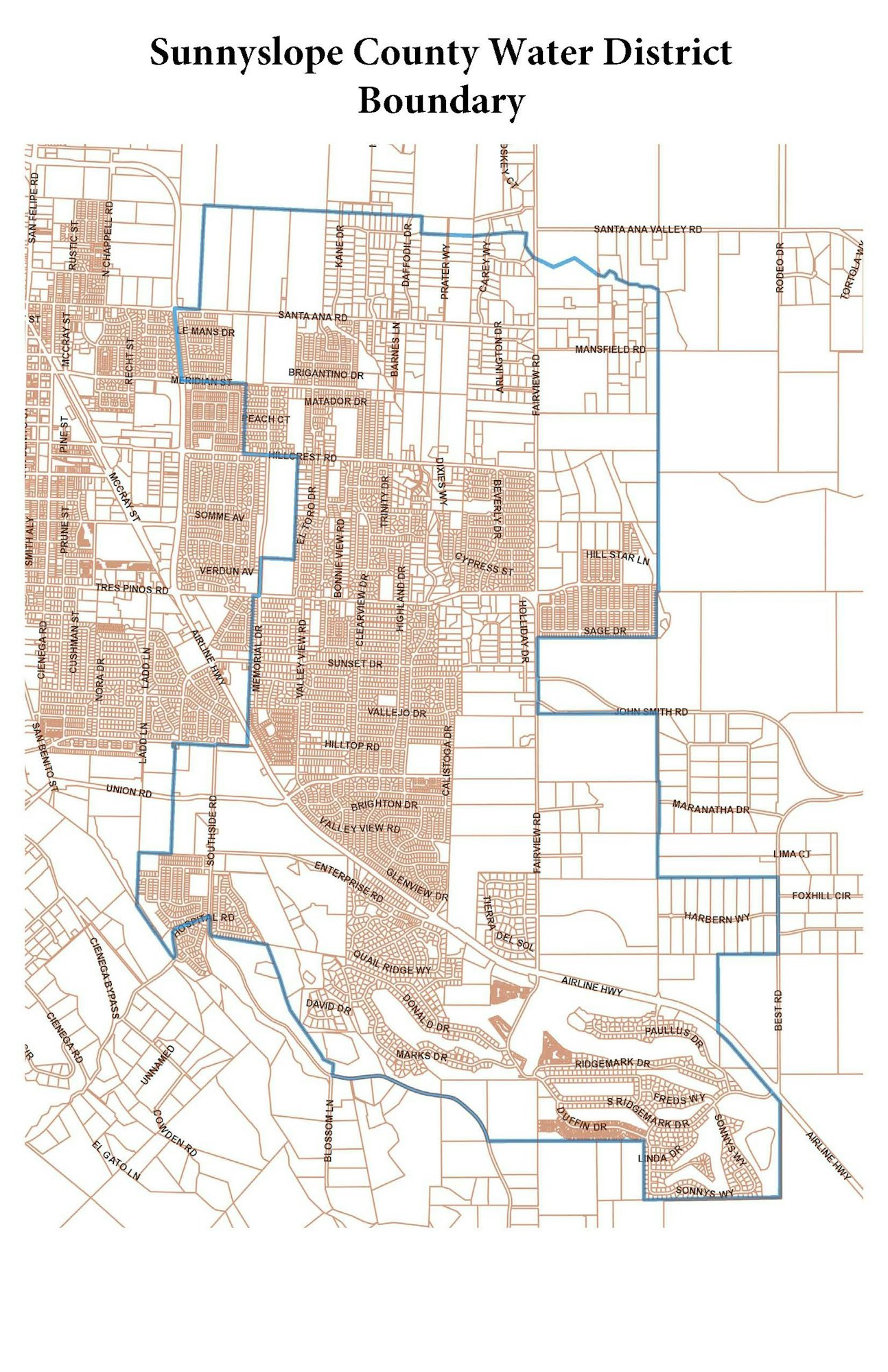
Sunnyslope County Water District is moving forward with a concerted effort to move away from District At-Large election format and adopt 5 equal District Zones as defined by the Calfornia Voter Rights Act (CVRA) requirements. With input received so far the Demographic Consultant hired by the District has proposed the map examples below.
Attached below you will find 5 map examples under consideration by the Board of Directors.
Also follow this interactive review map link to view the five initial draft mapsnow available for public and Board consideration.
The PDF maps are easy to print, but the easy-to-use interactive review map is a much better way to see the details of exactly where the boundaries end up in each map.
Each attached PDF has two pages: the first is the map, followed by a page with the demographic profile of each proposed division in that map.
In an effort to give the public and Board a sense of the options and trade-offs with each option ,each map has a different focus. And each obviously has a different resulting impact on neighborhoods and communities of interest, though each map minimizes neighborhood and community divisions as much as possible.
- Green map is highly compact, with clear, north, north-central, central, southern Hollister, and Ridgemark divisions.
- Orange is similarly very compact, but divisions 1 and 2 are more side-by-side than on top of each other, 3 shifts to be a center-west division, and 4 and 5 blend southern Hollister and unincorporated population.
- Tangerine map is a combination of considerations from both the Green and the Orange maps which follow strong nieghborhood boundaries.
- Maroon minimizes (as much as possible while still containing the required number of people) the City of Hollister population in northern division 2 and southern divisions 5. Div 3 thus has an odd shape as it follows the city border to the northeast, and Div 2 has an odd shape as it avoids that northeast incorporated area.
- Tan connects Ridgemark with the southeastern edge of Hollister and the unincorporated areas east of the city in Div 5, then has highly compact Divisions 1-4 going from north to south through the western and central regions of the Water District.
VIEW PDF MAPS HERE
Green.pdfMaroon.pdfTangerine.pdfOrange.pdfTan.pdfProposed Sequencing.pdf
The preparation of these maps have followed CVRA criteria. The statutory criteria are, in prioritized order:
(1) equal population;
(2) comply with the federal voting rights act;
(3) contiguous;
(4) minimize divisions of neighborhoods and communities of interest;
(5) minimize divisions of cities and census designated places;
(6) follow easily recognizable boundaries; and
(7) be compact (meaning do not bypass one group of people to get to another group of people unless necessary to achieve a higher-ranked criterion).
Maps may not have the "purpose of favoring or discriminating against an incumbent, political candidate, or political party."
All the maps are within the allowed population range for each division, contiguous, comply with the federal voting rights act, and avoid dividing the census designated place of Ridgemark (Hollister is so big and centrally positioned that a part of the city has to be in each of the 5 divisions).
QUESTIONS REGARDING THIS PROCESS can be emailed directly to elections@sunnyslopewater.org
The Public is invited to participate in this effort to create fair and consistent District boundaries.
Published Timeline
The current timeline, subject to change, is the following:
· January 28 (Complete) Board adopted Resolution of Intent to Change to By-Division Elections
Resolution 607 adopting the District intent to trasition to By-District Elections can be viewed here:
READ THE ADOPTED RESOLUTION
Resolution 607- By-District Elections.pdf- February 25 (Complete) - First hearing (community education and information‐gathering ‐‐ no draft maps)
At the February meeting the Board met to discuss the process and to adopt this published timeline for accomplishing the re-districting of Sunnyslope. These changes will be effective prior to the 2026 election cycle when 3 board seats will be open for election.
- March 25 (Complete) - Second hearing (community education and information‐gathering ‐‐ no draft maps)
The District consultant NDC will present the attached power point at the March 25th Board Meeting
Pursuant to Election Code Section 21130 (b), the attached memo serves as the Sunnyslope Water District's disclosure report
I-1a Sunnyslope 21130b disclosure report.pdfVIEW POWER POINT
I-1a ReDistricting PowerPoint.pdf- APRIL 15TH SPECIAL MEETING (Complete) - (first discussion of draft maps ‐ Board may request new or revised maps for consideration at the 4th hearing)
- April 22 - This meeting was originally contemplated to be the third meeting, but with the Special meeting occurring on the 15th to gather additional public feedback the April 22 meeting will be the second review of the attached maps as revised pending the April 15th discussion. If no map changes are made or requested, the fifth hearing and adoption vote may (but does not have to be) be held as a separate agenda item at this meeting too.
- May 20 Fifth hearing is tentitive for addtional discsion pending public input.
CURRENT DISTRICT BOUNDARIES